 |
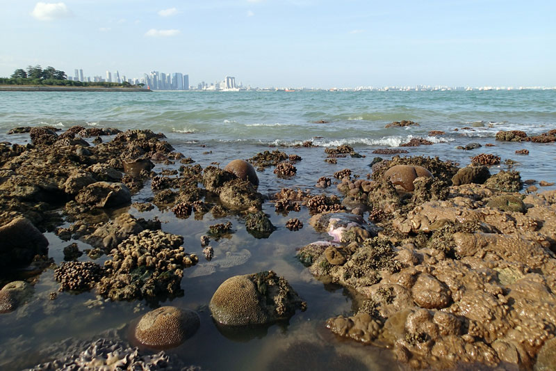
| Kusu reef with Singapore's cityscape in the distance. |
Saturday, February 1, 2014
Kusu Reef: A reef with the lion city view under lots of stress
The reef at Kusu Island is rather unique. It is one reef that has a special view - The cityscape of Singapore. This view can be reach with a 15 mintues ferry ride from Marina South Pier.
Kusu Island is managed by Sentosa. All visitors are required to pay an entrance fee of SG$0.50 upon arrival at the island. On this island, there is a chinese temple and three Kramats. You can read more about Kusu Island here.

Friday, January 31, 2014
Kusu Island Oiled
On the eve of lunar new year, the Maritime and Port Authority of Singapore (MPA) release a media statement regarding 'Contact between vessels NYK Themis and AZ Fuzhou' - MPA News centre, 30 January 2014.
A collision between the vessels happened at East Keppel Fairway at about 4 km south of Marina South. "NYK Themis" is a Panama-flagged containership while "AZ Fuzhou" is a barge being towed by "AZ Carnation". Here's a estimated location mapped out by Ria Tan (wildsingapore) to show collision spot.
 |
| Estimated collision site |
Saturday, January 25, 2014
My love for TMSI-SJI
The Tropical Marine Science Institute, TMSI in short, is an institution formed with the National University of Singapore (NUS). The institution aims to play a strong role in promoting integrated marine science, in research and development, as well as to establish itself as a regional and international education and training centre through active collaboration with academic, government and industrial sectors. Major research areas in TMSI are Marine Environmental Management; Underwater Remote Sensing and Oceanography.
There are two TMSI research facilities - one located on the main campus of NUS at Kent Ridge while second is located off mainland Singapore at St. John's Island (SJI). The institution also has research vessel, Galaxea, allowing researchers to conduct experiment in Singapore waters.
 |
| TMSI homepage www.tmsi.nus.edu.sg |
 |
| The Galaxea [Image from TMSI's webpage, http://www.tmsi.nus.edu.sg/research-facilities-galaxea] |
Saturday, January 4, 2014
A new year, a new life on Chek Jawa
The new year marks the start of a slow progression towards intertidal fieldtrips as the low tide period starts to get lower and shifts from evening low tides to morning low tides. It is a great feeling to be back on the shore again, after about 1.5 months break due to the unfavourable low tides since mid November last year.
The first intertidal fieldtrip of 2014 begins at Chek Jawa. With heavy rain pouring almost daily throughout November to December and the eastern part of peninsular Malaysia being hit by floods, we were worried if Chek Jawa will be affected by large amount of freshwater flowing down the Johor river. Chek Jawa is located on the eastern end of Pulau Ubin where discharge from the nearby Johor River is directed at.
The first intertidal fieldtrip of 2014 begins at Chek Jawa. With heavy rain pouring almost daily throughout November to December and the eastern part of peninsular Malaysia being hit by floods, we were worried if Chek Jawa will be affected by large amount of freshwater flowing down the Johor river. Chek Jawa is located on the eastern end of Pulau Ubin where discharge from the nearby Johor River is directed at.
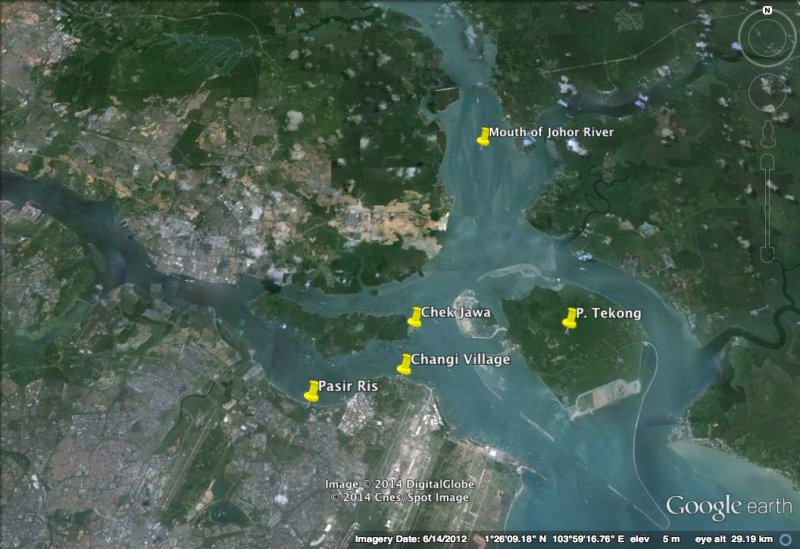 |
| Location of Johor River mouth. |
Thursday, November 7, 2013
Tanjung Rimau Security Barriers - Some changes and slight improvements
The sky presented itself with a beautiful sunset as I did an update on the security barriers at Tanjung Rimau, Sentosa.
How have the security barriers progressed after my last visit in August 2013? Were there improvements done or has situation worsened?
There were only one obvious change made to the line of security barriers at Tg Rimau. The drums chained on the high shore, some of which were broken, were removed.
Let us see the progression of the drums on the high shore since I started documenting this in April 2013.
Here's a picture I took in August, showing where the blue drums starts from the high shore.
Here's the picture I took on this trip landwards, showing that the blue drums starts on the rocky - sandy high shore.
With the drums removed from the high shore, no more sighs of broken drums and contents spilling onto the rocky surfaces.
This is where the line of drums begins from the shore. The concrete cube is visible in the background.
I am not sure if the drums are serviced and changed regularly, but when the tides goes out, the organisms (mostly algae and some barnacles) growing on the lower parts of the drums are revealed.
Other than the improvements done on the high shore, the rest of the line looks the same as what I saw during my last visit. The concrete cube which the line of drums is attached to is still sitting at the spot while the drums forms a corner.
Here's an overview video of the security barrier line near the concrete cube is.
As it was an evening trip, I had to move and work fast checking out this barrier line as it is rather difficult to document them when the light goes dim in the sky.
As mentioned in my previous update about the security barriers, there was a tilted buoy along this line of barriers which might have caused the change in the outline of the barriers on this shore. The image taken in August showed the buoy tilted at about 45 degrees to the horizon.
On this trip, the same buoy is resting on the reef and it looks different. The buoy is almost horizontal on the reef.
On the reef where the buoy is resting on, it looks pale as though the parts have been scraping the surface.
I am assuming that this is the same buoy as the one I saw in August. Some markings have "disappeared" and it is difficult to make comparison.
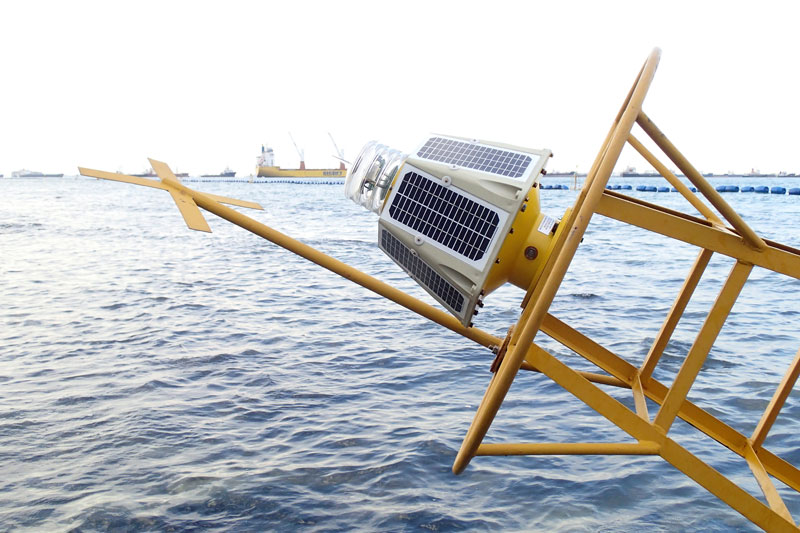
The blinking light attached at the tip of the buoy had been removed. And so is the stick with the cross.
The whole buoy is slowly being encrusted with some parts probably rusting away. This is a view where the blinking light was attached with the solar panels.
It was rather "exciting" having a closer look at this buoy as the ferry services to and from Batam make use of the waterway in front of this shore. This means that each time the ferry passes by, large waves generated by the ferry will reach the shore at Tg Rimau. Even at low tide, these large waves are rather strong, especially when I was already standing in just below knee deep water at the buoy. I had to scramble for slightly higher ground on the reef on two occasions, right next the circular structure while I grabbed onto the structure of the buoy.
This video will show how strong the ferry generated waves can be as they head towards the shallow shore.
There was a drum near the buoy that looked rather dented.
Armed with a GPS device, I marked some coordinates along the security barrier line and tried to map out more accurate points on Google Earth. The purple line shows the rough line of the security barriers with the help of 5 GPS coordinate points. The short red line is the chain from the concrete cube to the drum "corner". The GPS coordinate marking end at the buoy ("Beacon" on the image).
The shore at Tg Rimau is still pretty much alive as the sunsets. I came across many clusters of Tape Seagrass (Enhalus acoroides).
The shore area after the start of the barrier was so densely covered with the Hairy green seaweed (Bryopsis sp.) that I have to carefully place my foot so that I do not step on loose pieces of rubble or animals hiding under the seaweeds.
Unfortunately, my compact flash card from my DSLR has some problems and I could not extract out the photos. So no critter updates on what I saw during this trip. Hope that I will be able to recover my photos in that card.
Read more about the security barriers at Sentosa (in chronological order):
Security Barriers at Tanjung Rimau, Sentosa [28 April 2013]
Updates on Security Barrier at Tanjung Rimau, Sentosa [10 August 2013]
 |
| Sunset from Sentosa |
There were only one obvious change made to the line of security barriers at Tg Rimau. The drums chained on the high shore, some of which were broken, were removed.
Let us see the progression of the drums on the high shore since I started documenting this in April 2013.
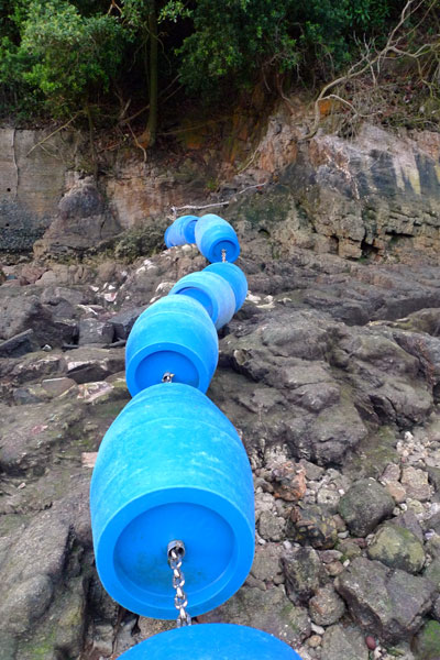 |
| [Image taken in April 2013] |
 |
| Blue drums starts right next to where this photo was taken, furthest on the high shore. [Image from August 2013] |
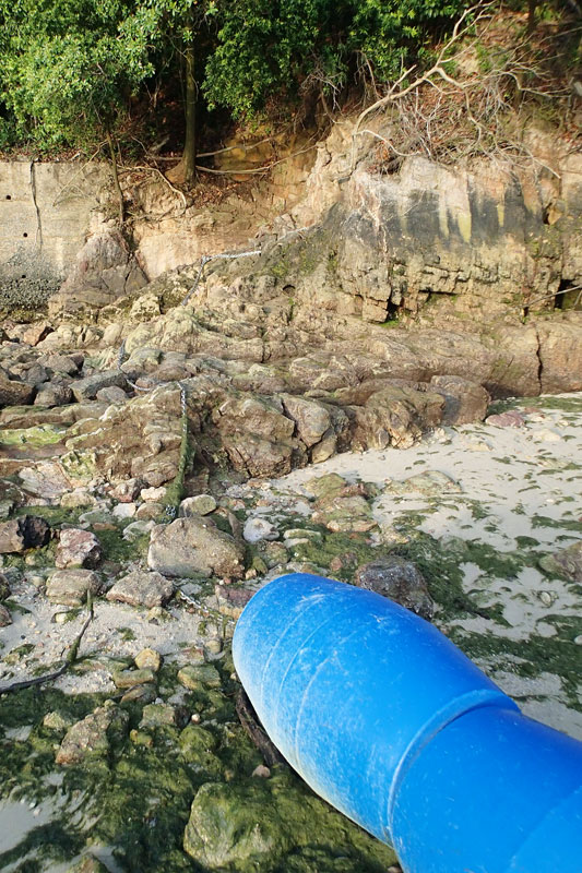 |
| Obvious different between the April photo and the photo taken on this trip. |
 |
| Wider view of the high shore, where the connecting chains can be seen. |
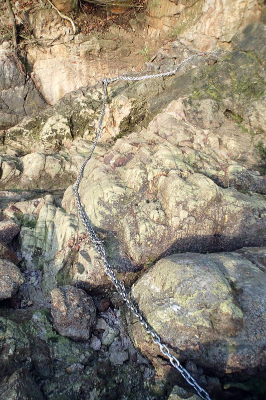 |
| The chains are anchored at the same spot. |
 |
| Start of the line of drums. |
 |
| Blue drums resting on the reefy shore when the tides goes out. |
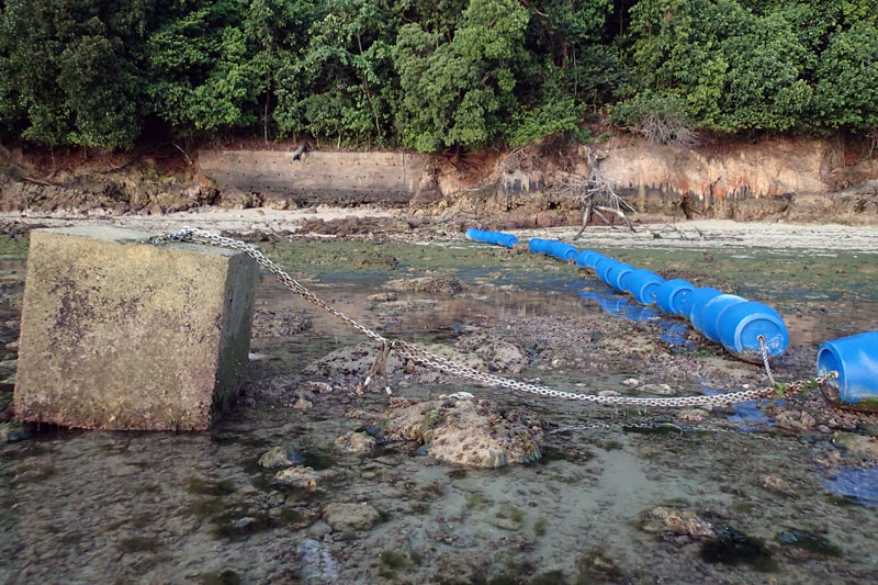 |
| Concrete cube and drum corner. |
As it was an evening trip, I had to move and work fast checking out this barrier line as it is rather difficult to document them when the light goes dim in the sky.
As mentioned in my previous update about the security barriers, there was a tilted buoy along this line of barriers which might have caused the change in the outline of the barriers on this shore. The image taken in August showed the buoy tilted at about 45 degrees to the horizon.
 |
| Tilted buoy documented in August. |
 |
| The buoy at the same location. |
 |
| Buoy on the reef. |
 |
| Pale surfaces caused by the buoy? |
 |
| Markings on the lower part of the buoy - "PCG" and "01" [Image taken in August] |
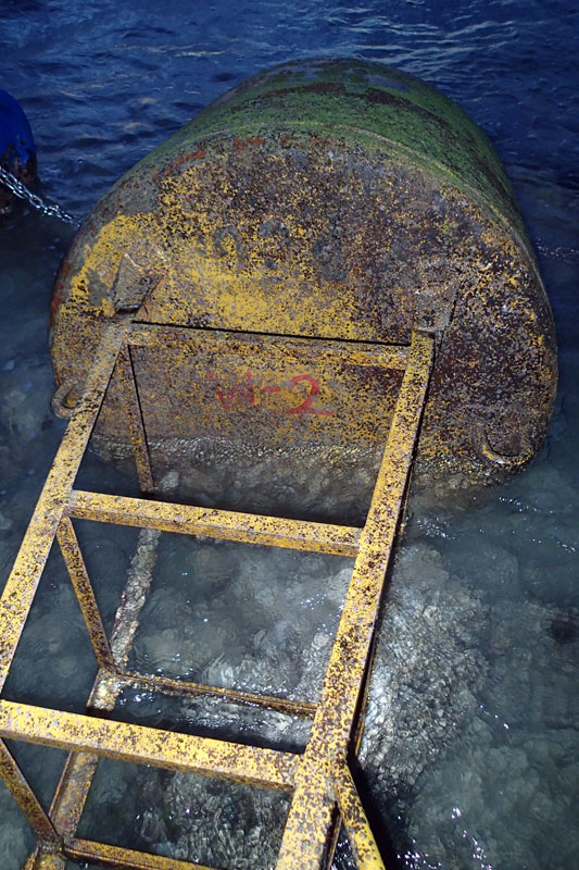 |
| Image taken on this trip - Barely visible "PCG", missing "01", addition "W-2" markings |
 |
| Top of buoy, blinking light and cross point present. [Image taken in August] |
 |
| Cross point and blinking light missing. |
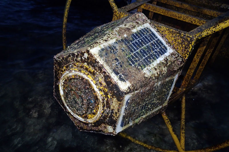 |
| Rusting top and encrusted solar panels. |
 |
| View of the whole buoy. |
This video will show how strong the ferry generated waves can be as they head towards the shallow shore.
There was a drum near the buoy that looked rather dented.
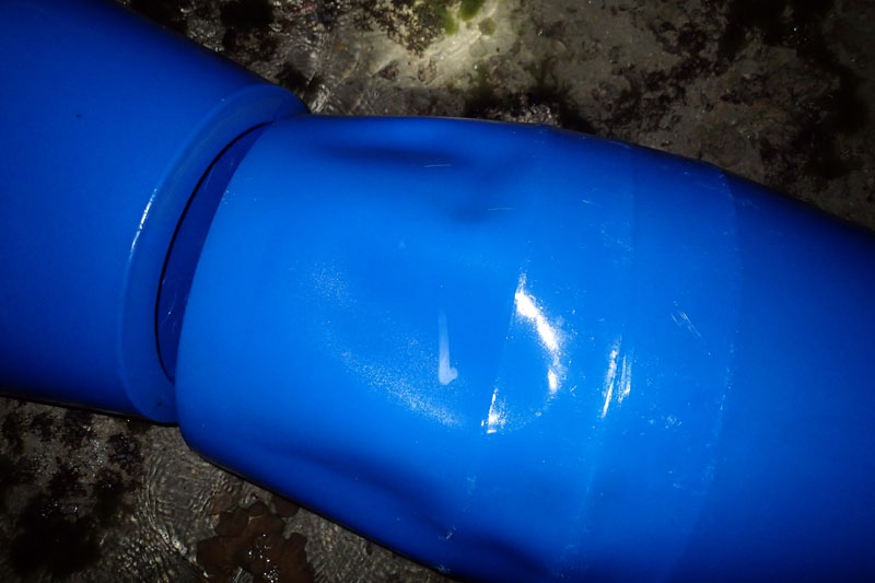 |
| Dented drum. |
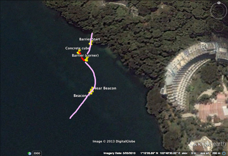 |
| Purple line shows the line of security barriers. |
 |
| Tape seagrass |
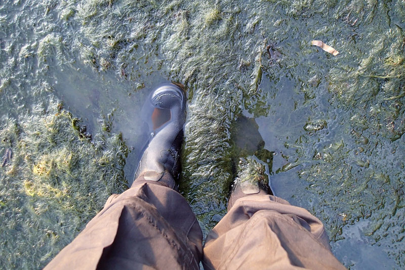 |
| Thick layer of hairy green seaweed on the shore. |
Read more about the security barriers at Sentosa (in chronological order):
Security Barriers at Tanjung Rimau, Sentosa [28 April 2013]
Updates on Security Barrier at Tanjung Rimau, Sentosa [10 August 2013]
Subscribe to:
Posts (Atom)
LinkWithin
